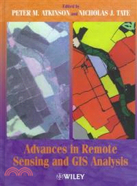
Advances In Remote Sensing & Gis Analysis
商品資訊
定價
:NT$ 14648 元優惠價
:90 折 13183 元
若需訂購本書,請電洽客服 02-25006600[分機130、131]。
相關商品
商品簡介
目次
商品簡介
An authoritative and state-of-the-art book bringing together some of the most recent developments in remote sensing and GIS analysis with a particular emphasis on mathematical techniques and their applications.
With contributions from academia, industry and research institutes, all with a high standing, this book covers a range of techniques including: fuzzy classification, artificial neural networks, geostatistical techniques (such as kriging, cokriging, stochastic simulation and regularization, texture classification, fractals, per-parcel classification, raster and vector data integration and process modelling. The range of applications includes land cover and land use mapping, cloud tracking, snow cover mapping and air temperature monitoring, topographic mapping, geological classification and soil erosion modelling.
This book will be valuable to both researchers and advanced students of remote sensing and GIS. It contains several new approaches, recent developments, and novel applications of existing techniques. Most chapters report the results of experiment and investigation. Some chapters form broad reviews of recent developments in the field. In all cases, the mathematical basis is fully explained.
目次
Techniques for the Analysis of Spatial Data (P. Atkinson & N. Tate).
Land Cover Classification Revisited (P. Mather).
Image Classification with a Neural Network: From Completely-Crisp to Fully-Fuzzy Situations (G. Foody).
Cloud Motion Analysis (H. Lewis, et al. ).
Methods for Estimating Image Signal-to-Noise Ratio (SNR) (G. Smith & P. Curran).
Modelling and Efficient Mapping of Snow Cover in the UK for Remote Sensing Validation (R. Kelly & P. Atkinson).
Using Variograms to Evaluate a Model for the Spatial Prediction of Minimum Air Temperature (D. Cornford).
Modelling the Distribution of Cover Fraction of a Geophysical Field (J. Collins & C. Woodcock).
Classification of Digital Image Texture Using Variograms (J. Carr).
Geostatistical Approaches for Image Classification and Assessment of Uncertainty in Geologic Processing (F. van der Meer).
A Syntactic Pattern-Recognition Paradigm for the Derivation of Second-Order Thematic Information from Remotely Sensed Images (S. Barr & M. Barnsley).
The R?le of Classified Imagery in Urban Spatial Analysis (V. Mesev & P. Longley).
Image Classification and Analysis Using Integrated GIS (J. Hinton).
Per-Field Classification of Land Use Using the Forthcoming Very Fine Spatial Resolution Satellite Sensors: Problems and Potential Solutions (P. Aplin, et al. ).
Modelling Soil Erosion at Global and Regional Scales Using Remote Sensing and GIS Techniques (N. Drake, et al. ).
Extracting Information from Remotely Sensed and GIS Data (P. Atkinson & N. Tate).
Index.
主題書展
更多
主題書展
更多書展本週66折
您曾經瀏覽過的商品
購物須知
外文書商品之書封,為出版社提供之樣本。實際出貨商品,以出版社所提供之現有版本為主。部份書籍,因出版社供應狀況特殊,匯率將依實際狀況做調整。
無庫存之商品,在您完成訂單程序之後,將以空運的方式為你下單調貨。為了縮短等待的時間,建議您將外文書與其他商品分開下單,以獲得最快的取貨速度,平均調貨時間為1~2個月。
為了保護您的權益,「三民網路書店」提供會員七日商品鑑賞期(收到商品為起始日)。
若要辦理退貨,請在商品鑑賞期內寄回,且商品必須是全新狀態與完整包裝(商品、附件、發票、隨貨贈品等)否則恕不接受退貨。


