

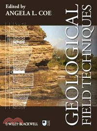
GEOLOGICAL FIELD TECHNIQUES
商品資訊
商品簡介
Geological Field Techniques is designed for students, amateur enthusiasts and professionals who have a background in geology and wish to collect field data on rocks and geological features. Teaching aspects of this textbook include:
- step-by-step guides to essential practical skills such as using a compass-clinometer, making a geological map and drawing a field sketch;
- tricks of the trade, checklists, flow charts and short worked examples;
- over 200 illustrations of a wide range of field notes, maps and geological features;
- appendices with the commonly used rock description and classification diagrams;
- a supporting website hosted by Wiley Blackwell.
作者簡介
Dr Tom W. Argles is a geologist who has conducted structural and metamorphic fieldwork in several mountain belts (Alps, Himalaya, Betic Cordillera, Caledonides, Basin and Range) for 20 years. He has set up and taught field courses in a range of locations across the UK and Europe
Dr David A. Rothery is a volcanologist and planetary scientist. He has taught geology in the field for 30 years and has research experience of igneous rocks (including active volcanoes) in the Oman, Cyprus, Italy, the Andes, central America, NW USA, Hawaii and Western Australia.
Professor Robert A. Spicer is a palaeobotanist and sedimentologist with over 30 years field experience working in remote regions of Northern Alaska and northeastern Russia, China and Tibet, India, Australia, New Zealand, and Mexico.
目次
Acknowledgements.
1 Introduction.
1.1 A selection of general books and reference material on geology.
1.2 Books on geological field techniques.
2 Field equipment and safety.
2.1 Introduction.
2.2 The hand lens and binoculars.
2.3 The compass-clinometer.
2.3.1 Orientation of a dipping plane.
2.3.2 Orientation of a linear feature.
2.3.3 Triangulation: Determining location using a compass.
2.4 Global positioning systems and altimeters.
2.5 Measuring distance and thickness.
2.5.1 Standard thickness and distance measurements.
2.5.2 Use of the Jacob staff to measure the thickness of inclined strata.
2.6 Classification and colour charts.
2.7 Hammer, chisels and other hardware.
2.8 The hardcopy field notebook.
2.9 The laptop, netbook or PDA as a notebook.
2.10 Writing equipment, maps and relevant literature.
2.10.1 Writing equipment.
2.10.2 Maps and relevant literature.
2.11 Comfort, field safety and field safety equipment.
2.11.1 Clothes, backpack/rucksack and personal provisions.
2.11.2 Field safety.
2.11.3 Field safety equipment.
2.12 Conservation, respect and obtaining permission!.
2.13 Further reading.
3 Introduction to field observations at different scales.
3.1 Introduction: What, where and how?.
3.1.1 Defining the fieldwork objective.
3.1.2 Deciding where to do the fieldwork.
3.1.3 Locating your position.
3.2 Scale of observation, where to start and basic measurements.
3.2.1 Regional context.
3.2.2 Whole exposure.
3.2.3 Hand specimens.
3.3 Overview of possible data formats.
4 The field notebook.
4.1 Introduction: The purpose of field notes.
4.2 Field notebook layout.
4.2.1 Preliminary pages.
4.2.2 Daily entries.
4.2.3 General tips.
4.3 Field sketches: A picture is worth a thousand words.
4.3.1 General principles: Aims, space and tools.
4.3.2 Sketches of exposures.
4.3.3 Sketching metre- and centimetre-scale features.
4.3.4 Sketch maps.
4.4 Written notes: Recording data, ideas and interpretation.
4.4.1 Notes recording data and observations.
4.4.2 Notes recording interpretation, discussion and ideas.
4.5 Correlation with other data sets and interpretations.
5 Recording palaeontological information.
5.1 Introduction: Fossils are smart particles.
5.1.1 Why are fossils important?.
5.1.2 Collecting fossil data.
5.2 Fossil types and preservation.
5.2.1 Body fossil classification.
5.2.2 Body fossil preservation.
5.2.3 Trace fossils.
5.2.4 Molecular fossils.
5.3 Fossil distribution and where to find them.
5.3.1 Transported or life position?.
5.4 Sampling strategies.
5.4.1 Sampling for biostratigraphic or evolutionary studies.
5.4.2 Sampling of bedding surfaces and palaeoecology.
5.5 Estimating abundance.
5.5.1 Presence/absence and qualitative abundance estimates.
5.5.2 Quantitative measures of abundance.
5.5.3 How many samples are required?.
5.6 Summary.
5.7 Further reading.
6 Recording features of sedimentary rocks and constructing graphic logs.
6.1 Introduction.
6.2 Description, recognition and recording of sedimentary deposits and sedimentary structures.
6.2.1 Recording sedimentary lithology.
6.2.2 Recording sedimentary structures.
6.3 Graphic logs.
6.3.1 Conventions for graphic logs.
6.3.2 Constructing a graphic log.
6.4 Rocks in space: Reconstructing sedimentary environments and their diagnostic features.
6.5 Using sedimentary rocks to interpret climate change and sea-level change.
6.5.1 Climate change.
6.5.2 Sequence stratigraphy and relative sea-level change.
6.6 Further reading.
7 Recording features of igneous rocks.
7.1 Equipment, basic tips and safety.
7.2 Field relationships of igneous rocks.
7.2.1 Relationships with surrounding rocks.
7.2.2 Internal architecture: Joints and veins.
7.2.3 Internal architecture: Other exposure-scale fabrics.
7.3 Mineralogy and small-scale textures of igneous rocks.
7.3.1 Petrologic type.
7.3.2 Mineral texture and fabric.
7.4 Recent and active volcanoes.
7.4.1 Equipment and safety.
7.4.2 Access.
7.4.3 Observations.
7.5 Further reading.
8 Recording structural information.
8.1 Equipment and measurement.
8.1.1 Structural measurements and notations.
8.2 Brittle structures: Faults, joints and veins.
8.2.1 Planar brittle features – orientation.
8.2.2 Determining past motion on brittle structures.
8.3 Ductile structures: Shear zones, foliations and folds.
8.3.1 Orientation of ductile planar features.
8.3.2 Direction of shear/stretching: Stretching lineations.
8.3.3 Sense of shear: Kinematic indicators.
8.3.4 Magnitude of shear strain.
8.3.5 Fold analysis.
8.4 Further reading.
9 Recording features of metamorphic rocks.
9.1 Basic skills and equipment for metamorphic fieldwork.
9.1.1 Field relations and context.
9.2 Textures.
9.2.1 Banding.
9.2.2 Grain textures.
9.2.3 Reaction textures.
9.3 Mineralogy.
9.3.1 Identifying common metamorphic minerals.
9.3.2 Using mineral assemblages.
9.3.3 Classification of metamorphic rocks.
9.4 Unravelling metamorphism and deformation.
9.4.1 Pre-kinematic features.
9.4.2 Syn-kinematic features.
9.4.3 Post-kinematic features.
9.5 Further reading.
10 Making a geological map.
10.1 Principles and aims.
10.2 Preparation and materials.
10.2.1 Base maps and other aids.
10.2.2 Equipment for mapping.
10.3 Location, location, location.
10.3.1 Equipment.
10.3.2 Using base maps.
10.4 Making a field map.
10.4.1 Information to record on field maps.
10.4.2 The evolving map.
10.4.3 Sketch cross-sections.
10.5 Mapping techniques.
10.5.1 Traverse mapping.
10.5.2 Contact mapping.
10.5.3 Exposure mapping.
10.5.4 Using other evidence.
10.6 The geological map.
10.6.1 Inking in the field map.
10.6.2 Cross-sections.
10.6.3 Fair copy maps.
10.6.4 Digital maps and GIS.
10.7 Further reading.
11 Recording numerical data and use of instruments in the field.
11.1 Data collection.
11.1.1 Instrument calibration and base stations.
11.1.2 Survey grid.
11.2 Transport and protection of the instruments.
11.3 Correlation with other data sets.
11.4 Further reading.
12 Photography.
13 Sampling.
13.1 Selecting and labelling samples.
13.1.1 Samples for thin-sections.
13.1.2 Orientated samples.
13.1.3 Samples for geochemical analysis.
13.1.4 Samples for mineral extraction.
13.1.5 Samples for fossils.
13.1.6 Sampling for regional studies.
13.1.7 High-resolution sample sets.
13.1.8 Labelling samples and their packaging.
13.2 Practical advice.
13.2.1 Packing and marking materials.
13.2.2 Extraction of samples.
14 Concluding remarks.
14.1 Further reading on scientific report writing.
References.
Appendix A1: General.
Appendix A6: Sedimentary.
Appendix A7: Igneous.
Appendix A8: Structural.
Appendix A9: Metamorphic.
Appendix A10: Mapping.
Index.


您曾經瀏覽過的商品

購物須知
外文書商品之書封,為出版社提供之樣本。實際出貨商品,以出版社所提供之現有版本為主。部份書籍,因出版社供應狀況特殊,匯率將依實際狀況做調整。
無庫存之商品,在您完成訂單程序之後,將以空運的方式為你下單調貨。為了縮短等待的時間,建議您將外文書與其他商品分開下單,以獲得最快的取貨速度,平均調貨時間為1~2個月。
為了保護您的權益,「三民網路書店」提供會員七日商品鑑賞期(收到商品為起始日)。
若要辦理退貨,請在商品鑑賞期內寄回,且商品必須是全新狀態與完整包裝(商品、附件、發票、隨貨贈品等)否則恕不接受退貨。