

定價
:NT$ 2700 元無庫存,下單後進貨(到貨天數約30-45天)
可得紅利積點:81 點
相關商品
商品簡介
作者簡介
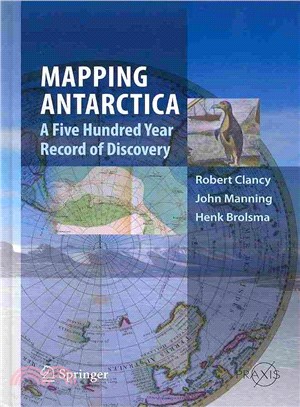
商品簡介
Everyone likes maps and maps are always used to illustrate the many books on the Antarctic. Here the focus is reversed with contemporary maps telling the story – one that should be attractive to the widest audience as it is a unique approach complimenting what has gone before and providing something different for all interested in Antarctica.
作者簡介
Robert Clancy is a Member of Order of Australia (for Immunology as well as Historic Cartology). He has made about 6 trips to Antarctica, as both a research scientist and as a tour guide (to both the Antarctic Peninsula and Australian bases). He has been collecting maps of Antarctica since 1972, and has written numerous articles on historic cartography of Australia and Antarctica, given many talks on similar topics and curated four exhibitions of maps related to these topics. He has written three books on maps (‘So Come They South’, ‘The Mapping of Terra Australis’, and ‘Shaping Australia: 1850-1950’). He is an International Secretary of the International Map Collectors Society (IMCoS) and has received the Inaugural Innovation Award at the University of Newcastle. John Manning has had a long career from 1956 to 2004 in surveying, mapping and geodesy in Antarctica and remote areas of Australia. This includes appointments as head of the Antarctic mapping Section of the Division of national mapping and eventually head of the Topographic Mapping Division, as well as chairman or secretary of the SCAR working group on Geodesy and Geographic information over 30 years until 2002. He has been closely involved in modern Australian mapping of the Antarctic since 1966. He has published some 120 technical papers on mapping cartography and photogrammetry. He was a contributing author to the "Readers Digest book on Antarctica". He retired from Geoscience Australia in 2004 as Group Leader Geodesy. Henk Brolsma has had a professional career in surveying and mapping for more than 30 years in different parts of the world. Since 1994 , he has held the position of Mapping officer at the Australian Antarctic Division. In that role he has been in charge of the production of more than a hundred scale maps (small, medium as well as large) of the Australian Antarctic territory in East Antarctica. This also includes a variety of topographic, thematic, bathymetric and satellite mapping. From 1996, he has been fundamentally involved in the establishment of the Australian Antarctic Data Centre and the extended development of its relational data base aspects. This includes an increasing use of aerial photography and satellite remote sensing, such as the application of digital terrain models for ice cap depiction for aviation operations. Today much of his work is involved with the design and delivery of digital online mapping, integrated with selected information such as nomenclature and remotely sensed imagery. He has been an Australian representative in the Scientific Committee for Antarctic research (SCAR) working groups for more than 10 years and is currently the elected chairman of the Standing Committee on Geographic Infrastructure.


您曾經瀏覽過的商品

購物須知
外文書商品之書封,為出版社提供之樣本。實際出貨商品,以出版社所提供之現有版本為主。部份書籍,因出版社供應狀況特殊,匯率將依實際狀況做調整。
無庫存之商品,在您完成訂單程序之後,將以空運的方式為你下單調貨。為了縮短等待的時間,建議您將外文書與其他商品分開下單,以獲得最快的取貨速度,平均調貨時間為1~2個月。
為了保護您的權益,「三民網路書店」提供會員七日商品鑑賞期(收到商品為起始日)。
若要辦理退貨,請在商品鑑賞期內寄回,且商品必須是全新狀態與完整包裝(商品、附件、發票、隨貨贈品等)否則恕不接受退貨。