

商品簡介
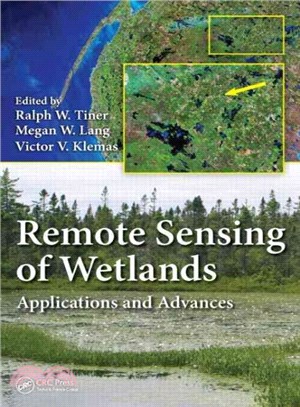
This book provides a thorough introduction to the use of remotely sensed data for wetland classification and mapping, as well as information on the latest technological advancements detailed by top scientists in the wetland classification and mapping field. It presents methods readily applicable to real-world challenges. The authors describe the best techniques for mapping and classifying wetlands in a multitude of different environments with commonly available data and with cost-effective methods. It also discusses the advantages and disadvantages of using different techniques in different environments.
作者簡介
Ralph W. Tiner recently retired from the U.S. Fish and Wildlife Service (FWS) where he served as regional wetland coordinator for the Northeast Region, Hadley, Massachusetts. He has been mapping wetlands since 1970, first as a graduate student at the University of Connecticut, then with the State of South Carolina, and finally as part of the FWS’s National Wetlands Inventory Program. Through his participation on national committees, he has helped standardize on-the-ground wetland delineation practices for implementing federal wetland regulations in the United States. He is editor of theWetland Science and Practice journal and the author of over 200 publications.
Megan W. Lang
is a research associate professor at the Department of Geographical Sciences, University of Maryland, College Park, Maryland. Her career in wetland sciences began in 1996, as an undergraduate student researching succession in abandoned rice fields while at the College of Charleston, South Carolina. She leads the U.S. Department of Agriculture Mid-Atlantic Wetland Conservation Effects Assessment Project, serves as an associate editor for the journalWetlands, and has published over 40 scientific articles and book chapters. She has also helped to develop wetland monitoring strategies for the state of Maryland and the United States.Victor V. Klemas
is professor emeritus at the School of Marine Science and Policy, University of Delaware, Newark, Delaware. Since 1976, he has directed the university’s Center for Remote Sensing, where he pioneered the application of a wide range of remote sensing techniques in the study of wetland and estuarine ecosystems in the United States and overseas. Dr. Klemas has published his research results in 120 scientific journal articles and coauthored several books. He has also served on six scientific committees of the National Research Council (National Academy of Science) and various government advisory panels.


您曾經瀏覽過的商品

購物須知
外文書商品之書封,為出版社提供之樣本。實際出貨商品,以出版社所提供之現有版本為主。部份書籍,因出版社供應狀況特殊,匯率將依實際狀況做調整。
無庫存之商品,在您完成訂單程序之後,將以空運的方式為你下單調貨。為了縮短等待的時間,建議您將外文書與其他商品分開下單,以獲得最快的取貨速度,平均調貨時間為1~2個月。
為了保護您的權益,「三民網路書店」提供會員七日商品鑑賞期(收到商品為起始日)。
若要辦理退貨,請在商品鑑賞期內寄回,且商品必須是全新狀態與完整包裝(商品、附件、發票、隨貨贈品等)否則恕不接受退貨。