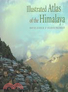
Illustrated Atlas of the Himalaya
商品資訊
ISBN13:9780813123882
出版社:Univ Pr of Kentucky
作者:David Zurick; Julsun Pacheco; Basanta Raj Shrestha; Birendra Bajracharya
出版日:2006/08/04
裝訂/頁數:精裝/211頁
規格:25.4cm*33.0cm*2.5cm (高/寬/厚)
定價
:NT$ 3600 元無庫存,下單後進貨(到貨天數約30-45天)
下單可得紅利積點:108 點
商品簡介
相關商品
商品簡介
Providing a panoramic overview of contemporary land and life in the Earth's highest mountains, the Illustrated Atlas of the Himalaya is the first full-color, comprehensive atlas of the geography, economics, politics, and culture of this spectacular area. Drawing from the authors' twenty-five years of scholarship and field experience in the region, the volume contains a stunning and unique collection of maps utilizing state-of-the-art cartography, exquisite photography, and engagingly written text to give accurate coverage of the Himalaya.
The volume covers the entire 2,700-kilometer length of the mountain range, from the Indus Valley in northern Pakistan and India, across Nepal and Bhutan, to the hidden realms of northeast India. The Illustrated Atlas of the Himalaya not only offers detailed explanations of geological formations, climate, vegetation, and natural resources but also explores the human dimension of the region's culture and economy. The authors devote special attention to discovery and travel, including exploration, mountaineering, and trekking.
Packed with over 300 easy-to-read, custom-designed full-color maps and photographs together with detailed text and map indexes, the Illustrated Atlas of the Himalaya is a superb collector's volume and an essential reference to this vast and complex mountain region.
主題書展
更多
主題書展
更多書展今日66折
您曾經瀏覽過的商品
購物須知
外文書商品之書封,為出版社提供之樣本。實際出貨商品,以出版社所提供之現有版本為主。部份書籍,因出版社供應狀況特殊,匯率將依實際狀況做調整。
無庫存之商品,在您完成訂單程序之後,將以空運的方式為你下單調貨。為了縮短等待的時間,建議您將外文書與其他商品分開下單,以獲得最快的取貨速度,平均調貨時間為1~2個月。
為了保護您的權益,「三民網路書店」提供會員七日商品鑑賞期(收到商品為起始日)。
若要辦理退貨,請在商品鑑賞期內寄回,且商品必須是全新狀態與完整包裝(商品、附件、發票、隨貨贈品等)否則恕不接受退貨。


