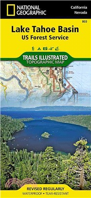
National Geographic Trails Illustrated Map Lake Tahoe Basin, USDA Forest Service ─ California / Nevada, USA
商品資訊
系列名:Trails Illustrated
ISBN13:9781566953344
替代書名:National Geographic Trails Illustrated Map Lake Tahoe Basin
出版社:Natl Geographic Maps
作者:National Geographic Maps
出版日:2006/01/01
裝訂/頁數:平裝/2頁
規格:23.5cm*11.4cm*1.3cm (高/寬/厚)
商品簡介
相關商品
商品簡介
‧ Waterproof ‧ Tear-Resistant ‧ Topographic Map
Trails are classified by use - hiking, horse and hike, mountain bike, shared use, or motorized - and includes a trail chart showing trail name, location, and allowed use. Trail mileage, private land designation, and information on general regulations, safety, Desolation Wilderness, camping, fishing, and snow parks round out the usefulness of this map. It also includes bathymetric shading of the Lake Tahoe.
Coverage includes Lake Tahoe Basin Management Unit, Eldorado, Humboldt-Toiyabe and Tahoe national forests. Desolation, Granite Chief and Mt. Rose Wilderness Areas. Pacific Crest National Scenic Trail. Tahoe Rim Trail. Rubicon OHV Trail. Emerald Bay, D.L. Bliss, Ed Z'Berg Sugar Pine, Burton Creek, Donner Memorial, Lake Tahoe Nevada, and Washoe Lake state parks. Mt. Tallac, Echo Summit, Carson Pass, Spooner Summit, Mt. Rose Summit, Brockway Summit. Towns: Truckee, Tahoe City, Homewood, Tahoma, South Lake Tahoe, Zephyr Cove, Incline Village, Kings Beach, Carson City. Includes UTM grids for use with your GPS unit and a trail mileage matrix.
- Sheet Size = 37.75 x 25.50
- Folded Size = 4.25 x 9.25
- Scale = 1:63,360
主題書展
更多
主題書展
更多書展今日66折
您曾經瀏覽過的商品
購物須知
外文書商品之書封,為出版社提供之樣本。實際出貨商品,以出版社所提供之現有版本為主。部份書籍,因出版社供應狀況特殊,匯率將依實際狀況做調整。
無庫存之商品,在您完成訂單程序之後,將以空運的方式為你下單調貨。為了縮短等待的時間,建議您將外文書與其他商品分開下單,以獲得最快的取貨速度,平均調貨時間為1~2個月。
為了保護您的權益,「三民網路書店」提供會員七日商品鑑賞期(收到商品為起始日)。
若要辦理退貨,請在商品鑑賞期內寄回,且商品必須是全新狀態與完整包裝(商品、附件、發票、隨貨贈品等)否則恕不接受退貨。


