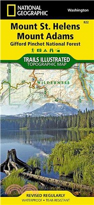
National Geographic Trails Illustrated Map Mount St. Helens/Mount Adams (Gifford-pinchot National Forest)
商品資訊
系列名:Trails Illustrated
ISBN13:9781566955058
替代書名:National Geographic Trails Illustrated Map Mount St. Helens/Mount Adams (Gifford-pinchot National Forest)
出版社:Natl Geographic Maps
作者:National Geographic Maps
出版日:2010/01/01
裝訂/頁數:平裝/2頁
規格:23.5cm*11.4cm*1.3cm (高/寬/厚)
商品簡介
相關商品
商品簡介
‧ Waterproof ‧ Tear-Resistant ‧ Topographic Map
Gifford- National Forest ‧ Washington, USA
One of five new Trails Illustrated maps for the Washington Cascades region offers the most detailed and up-to-date map for the forest, carefully researched and developed in co-operation with local land managers and agencies. Each map contains easy to read trails, numbered forest service roads, campsites, access points, scenic points-of-interests, and important facilities.
Along the west slope of Mount Adams lies the 46,353 acre Mount Adams Wilderness. The 12,236-foot high Mount Adams is the second highest peak in the Northwest after Mt. Rainier. The Yakima Indian Reservation bound Mount Adams Wilderness on the east. Wilderness trails offer the hiker spectacular views of Mount Adams and its glaciers, tumbling streams, open alpine forests, and wildflowers scattered among lava flows and rim rocks. Mount Adams is the biggest volcano in the state of Washington.
Mount St. Helens is an active volcano in southwest Washington state and the central feature of the Mount St. Helens National Volcanic Monument. It is a popular climb for both beginning and experienced mountaineers.
Like all Trails Illustrated maps our new Washington Cascades titles are both highly durable and environmentally friendly. Each map is printed in the United States, at a certified green printer, using low V.O.C. inks on waterproof, tear-resistant material. Proceeds from the sale of Trails Illustrated Maps go to support the National Geographic Society's nonprofit mission to increase global understanding and promote conservation of our planet through exploration, research, and education.
Coverage includes:
Mount Adams, Indian Haven and Trapper Creek Wilderness Areas, Mount St. Helens National Volcanic Monument, Mount Margaret Backcountry Area, Pacific Crest Trail, Spirit Lake Memorial Highway, Detailed Climbing and Permit Information Wilderness Coverage: Mount Adams, Indian Haven, Trapper Creek Other Attractions: Mount St. Helens National Volcanic Monument, Mount Margaret Backcountry Area, Hiking Trails, Mountain Biking, Scenic Back Roads, Mountain Climbing, Campgrounds, Sno-Parks, Fishing, Snowmobile Trails, Cross-Country Skiing, Waterfalls
- Sheet Size = 25.50 x 37.75
- Folded Size = 4.25 x 9.25
- Scale = 1:75,000
主題書展
更多
主題書展
更多書展今日66折
您曾經瀏覽過的商品
購物須知
外文書商品之書封,為出版社提供之樣本。實際出貨商品,以出版社所提供之現有版本為主。部份書籍,因出版社供應狀況特殊,匯率將依實際狀況做調整。
無庫存之商品,在您完成訂單程序之後,將以空運的方式為你下單調貨。為了縮短等待的時間,建議您將外文書與其他商品分開下單,以獲得最快的取貨速度,平均調貨時間為1~2個月。
為了保護您的權益,「三民網路書店」提供會員七日商品鑑賞期(收到商品為起始日)。
若要辦理退貨,請在商品鑑賞期內寄回,且商品必須是全新狀態與完整包裝(商品、附件、發票、隨貨贈品等)否則恕不接受退貨。


