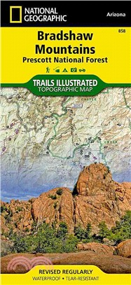
National Geographic Trails Illustrated Map Bradshaw Mountains, Prescott National Forest ― Arizona
商品資訊
系列名:National Geographic Trails Illustrated Map
ISBN13:9781566955171
出版社:Natl Geographic Maps
作者:National Geographic Maps
出版日:2010/01/01
裝訂/頁數:平裝/2頁
規格:23.5cm*11.4cm*1.3cm (高/寬/厚)
商品簡介
相關商品
商品簡介
‧ Waterproof ‧ Tear-Resistant ‧ Topographic Map
National Geographic's Bradshaw Mountains Trails Illustrated topographic map is the most comprehensive available for outdoor enthusiasts of all types. Designed to be easy-to-read, yet highly detailed – this map includes a comprehensive road and trail network distinguishing between major, secondary, high-clearance, primitive trails, motorized and non-motorized trails. All forest roads are labeled with their official road number and trails are clearly identified with their given name. Boundaries are color-coded and clearly shown for National Forest, National Monument, Ranger District, Wilderness Areas, County/Regional Parks, Military, Indian reservations, and State Wildlife Areas. Additionally, Arizona Game Management Unit (GMU) boundaries and public and private lands are clearly identified.
An extensive collection of important and unique locations are pinpointed on the map including: ranger districts, campgrounds, horse camps, picnic facilities, trailheads, gates, boat launches, river access sites, ATV trails, motorcycle trails, shooting ranges, and recreation sites with universal access capabilities.
Every National Geographic Trails Illustrated map is an essential tool for safely navigating the backcountry with GPS or compass as they are clearly marked with both Latitude/Longitude and UTM coordinate grids, compass rose with magnetic declination, scale bar, and full legend.
Some of the places shown on the west side of the Bradshaw Mountains map include: the town of Prescott, Prescott National Forest, Granite Mountain Wilderness, Alto Pitt OHV Area, Mt. Union, Spruce Mountain, Groom Creek, and more.
The west side of the map features: Prescott National Forest, Castle Creek Wilderness, Agua Fria National Monument, Bradshaw Mountains, Hayfield Draw OHV Area, Great Western Trail, Black Hills, Lynx Lake, Bald Mountain, Towers Mountain, and more.
The Trails Illustrated map is printed in the U.S.A. on a durable synthetic paper, making it waterproof, tear-resistant, and capable for withstanding any condition mother nature can dish out. The map is two-sided, and can be folded to a packable size of (4.25" x 9.25"), unfolded size is (26" x 38")."
Bradshaw Mountains adjoins our Apache Creek map to the north, our Sycamore Canyon map to the northeast, and our Mazatzal map to the southeast.
Net proceeds from the sale of this map go to support the non-profit mission of the National Geographic Society.
Specifications:
‧ Copyright 2010
‧ Scale 1:70,000 (1" = 1.1 mile)
‧ Contour Interval 50 feet
‧ Folded Size (4.25" x 9.25")
‧ Unfolded Size (26" x 38")
‧ NG Product Number (TI00000858)
- Map Scale = 1:70,000
- Sheet Size = 25.5" x 37.75"
- Folded Size = 4.25" x 9.25"
主題書展
更多
主題書展
更多書展今日66折
您曾經瀏覽過的商品
購物須知
外文書商品之書封,為出版社提供之樣本。實際出貨商品,以出版社所提供之現有版本為主。部份書籍,因出版社供應狀況特殊,匯率將依實際狀況做調整。
無庫存之商品,在您完成訂單程序之後,將以空運的方式為你下單調貨。為了縮短等待的時間,建議您將外文書與其他商品分開下單,以獲得最快的取貨速度,平均調貨時間為1~2個月。
為了保護您的權益,「三民網路書店」提供會員七日商品鑑賞期(收到商品為起始日)。
若要辦理退貨,請在商品鑑賞期內寄回,且商品必須是全新狀態與完整包裝(商品、附件、發票、隨貨贈品等)否則恕不接受退貨。


