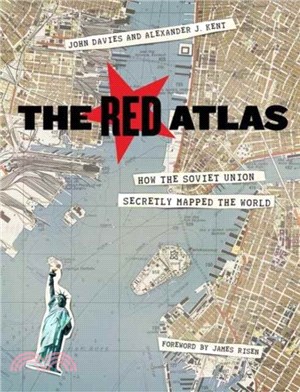
Red Atlas : How the Soviet Union Secretly Mapped the World
商品資訊
ISBN13:9780226389578
出版社:Univ of Chicago Pr
作者:John Davies; Alexander J. Kent
出版日:2017/10/17
裝訂/頁數:軟精裝/272頁
規格:23.5cm*19.1cm*2.5cm (高/寬/厚)
定價
:NT$ 1444 元優惠價
:90 折 1300 元
無庫存,下單後進貨(到貨天數約30-45天)
下單可得紅利積點:39 點
商品簡介
作者簡介
相關商品
商品簡介
Nearly thirty years after the end of the Cold War, its legacy and the accompanying Russian-American tension continues to loom large. Russia’s access to detailed information on the United States and its allies may not seem so shocking in this day of data clouds and leaks, but long before we had satellite imagery of any neighborhood at a finger’s reach, the amount the Soviet government knew about your family’s city, street, and even your home would astonish you. Revealing how this was possible, The Red Atlas is the never-before-told story of the most comprehensive mapping endeavor in history and the surprising maps that resulted.
From 1950 to 1990, the Soviet Army conducted a global topographic mapping program, creating large-scale maps for much of the world that included a diversity of detail that would have supported a full range of military planning. For big cities like New York, DC, and London to towns like Pontiac, MI and Galveston, TX, the Soviets gathered enough information to create street-level maps. What they chose to include on these maps can seem obvious like locations of factories and ports, or more surprising, such as building heights, road widths, and bridge capacities. Some of the detail suggests early satellite technology, while other specifics, like detailed depictions of depths and channels around rivers and harbors, could only have been gained by actual Soviet feet on the ground. The Red Atlas includes over 350 extracts from these incredible Cold War maps, exploring their provenance and cartographic techniques as well as what they can tell us about their makers and the Soviet initiatives that were going on all around us.
A fantastic historical document of an era that sometimes seems less distant, The Red Atlas offers an uncanny view of the world through the eyes of Soviet strategists and spies.
作者簡介
John Davies is editor of Sheetlines, the journal of the Charles Close Society for the Study of Ordnance Survey Maps. He lives in London. Alexander J. Kent is a reader in cartography and geographical information science at Canterbury Christ Church University and president of the British Cartographic Society.
主題書展
更多
主題書展
更多書展今日66折
您曾經瀏覽過的商品
購物須知
外文書商品之書封,為出版社提供之樣本。實際出貨商品,以出版社所提供之現有版本為主。部份書籍,因出版社供應狀況特殊,匯率將依實際狀況做調整。
無庫存之商品,在您完成訂單程序之後,將以空運的方式為你下單調貨。為了縮短等待的時間,建議您將外文書與其他商品分開下單,以獲得最快的取貨速度,平均調貨時間為1~2個月。
為了保護您的權益,「三民網路書店」提供會員七日商品鑑賞期(收到商品為起始日)。
若要辦理退貨,請在商品鑑賞期內寄回,且商品必須是全新狀態與完整包裝(商品、附件、發票、隨貨贈品等)否則恕不接受退貨。


