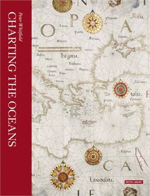
Charting the Oceans
商品資訊
ISBN13:9780712356169
出版社:British Library Board
作者:Peter Whitfield
出版日:2017/11/01
裝訂/頁數:平裝/208頁
規格:27.3cm*21.6cm*1.9cm (高/寬/厚)
版次:2
商品簡介
作者簡介
相關商品
商品簡介
Mastery of the sea has been crucial in world history: the transition from the medieval to the modern world was marked by the emergence of ships from their European home waters out into the Atlantic, Indian and Pacific Oceans. Solving the problem of ocean navigation was an essential prelude to achieving international powers and the maritime nations left a unique visual record of their response to the challenge of the sea. In succession Spanish, Portuguese, Dutch, French and English mariners used their charts to express their claims to sovereignty of the seas and territories newly revealed by their naval explorers. This revised and updated book traces the history of charts not as technical documents but as eloquent witnesses to the discovery of the world beyond Europe, and to man’s evolving knowledge of the oceans. These charts employed a vivid artistic idiom which expressed man’s passionate feeling for the sea: the gilded compasses, the nightmarish sea-creatures, the stately ships, the royal crests—all these were fused into a unique art-form, which flourished for four centuries. Featuring new photography of the British Library’s most important maritime maps, Charting the Oceans is the definitive guide to this majestic tradition.
作者簡介
Peter Whitfield is a leading expert in map history and exploration. His previous books include London: A Life in Maps and Cities of the World: A History in Maps.
主題書展
更多
主題書展
更多書展今日66折
您曾經瀏覽過的商品
購物須知
外文書商品之書封,為出版社提供之樣本。實際出貨商品,以出版社所提供之現有版本為主。部份書籍,因出版社供應狀況特殊,匯率將依實際狀況做調整。
無庫存之商品,在您完成訂單程序之後,將以空運的方式為你下單調貨。為了縮短等待的時間,建議您將外文書與其他商品分開下單,以獲得最快的取貨速度,平均調貨時間為1~2個月。
為了保護您的權益,「三民網路書店」提供會員七日商品鑑賞期(收到商品為起始日)。
若要辦理退貨,請在商品鑑賞期內寄回,且商品必須是全新狀態與完整包裝(商品、附件、發票、隨貨贈品等)否則恕不接受退貨。


