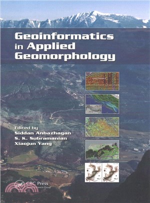
Geoinformatics in Applied Geomorphology
商品資訊
ISBN13:9781138074453
出版社:CRC Pr I Llc
作者:Siddan Anbazhagan (EDT); S. k. Subramanian (EDT); Xiaojun Yang (EDT)
出版日:2017/03/31
裝訂/頁數:平裝/397頁
規格:22.9cm*15.2cm (高/寬)
商品簡介
With recent innovations in the arena of remote sensing and geographic information systems, the use of geoinformatics in applied geomorphology is receiving more attention than ever. Geoinformatics in Applied Geomorphology examines how modern concepts, technologies, and methods in geoinformatics can be used to solve a wide variety of applied geomorphologic problems, such as characterization of arid, coastal, fluvial, aeolian, glacial, karst, and tectonic landforms; natural hazard zoning and mitigations; petroleum exploration; and groundwater exploration and management.
Using case studies to illustrate concepts and methods, this book covers:
- Arid environments, such as the Thar desert, West Texas, the Qatar Peninsula, and the Dead Sea areas
- Coastal shoreline changes in Kuwait
- Coastal zone management in India
- Estuarine bathymetric study of Tampa Bay, Florida
- Fluvial landforms of the Elbe river basin, Germany
- Subsurface coastal geomorphology and coastal morphological changes due to tsunamis in the East coast of India
- The Himalayas, Jammu & Kashmir, Western Ghats, and Precambrian terrain of South India
The result of extensive research by an interdisciplinary team of contributors, Geoinformatics in Applied Geomorphology is designed for students, researchers, and professionals in the areas of geomorphology, geological engineering, geography, remote sensing, and geographic information systems.
作者簡介
Prof. Siddan Anbazhagan is Director, Centre for Geoinformatics and Planetary studies, and Head, Department of Geology at Periyar University, India. He obtained PhD from Bharathidasan University (1995) and was awarded an Alexander von Humboldt Fellowship for his post-doctoral research in Germany. Dr. Anbazhagan’s research interests include remote sensing and GIS for applied geomorphology, hydrogeology and disaster mitigation. His current area of interest is planetary remote sensing. His research has been funded by ISRO, DST, MHRD and UGC. Anbazhagan has authored or co-authored more than 60 publications including an edited book on Exploration Geology and Geoinformatics. He serves as a reviewer for several remote sensing, environmental and water resources journals. He currently serves as Syndicate member and Coordinator for Research & Development in the Periyar University.
Dr. S.K.Subramanian is a Senior Scientist, heading Hydrogeology Division at National Remote Sensing Centre (NRSC), Hyderabad, India, Indian Space Research Organization (ISRO). He completed his higher education from IIT Bombay and Indian School of Mines. Dr. Subramanian has more than 30 years of professional experience in Remote Sensing and Geomorphology. He has coordinated number of National mission projects including Integrated Mission for Sustainable Development (IMSD), National (Natural) Resources Information System (NRIS), Rajiv Gandhi National Drinking Water Mission (RGNDWM) and National Agricultural Technology Project (NATP) especially in Geomorphology and Groundwater. In addition, he has been involved in several research projects including geomorphologic evolution of West Coast, mass movement in the Kosi catchment, geomorphology of Nepal, Chambal Ayacut of Rajasthan state and integrated studies and mapping of Dubai, UAE. He has authored or co-authored nearly 50 publications.
Xiaojun Yang is within the Geography Department of Florida State University, USA. He obtained BS in Geology from the Chinese University of Geosciences (CUG) (1986), MS in Paleontology from CUG's Beijing Graduate School (1989), MS in Applied Geomorphology from ITC (1995), and PhD in Geography from the University of Georgia (2000). His research interest includes the development of geospatial information science and technologies with applications in environmental and urban domains. His research has been funded by EPA, NSF, and NASA. He has authored or co-authored more than 80 publications including three books and six journal theme/special issues. He was Guest Editor for Environmental Management, ISPRS Journal of Photogrammetry and Remote Sensing, Photogrametrical Engineering and Remote Sensing, International Journal of Remote Sensing, and Computer, Environment and Urban Systems. He currently serves as Chair, Commission on Mapping from Satellite Imagery, International Cartographic Association.
主題書展
更多書展本週66折
您曾經瀏覽過的商品
購物須知
外文書商品之書封,為出版社提供之樣本。實際出貨商品,以出版社所提供之現有版本為主。部份書籍,因出版社供應狀況特殊,匯率將依實際狀況做調整。
無庫存之商品,在您完成訂單程序之後,將以空運的方式為你下單調貨。為了縮短等待的時間,建議您將外文書與其他商品分開下單,以獲得最快的取貨速度,平均調貨時間為1~2個月。
為了保護您的權益,「三民網路書店」提供會員七日商品鑑賞期(收到商品為起始日)。
若要辦理退貨,請在商品鑑賞期內寄回,且商品必須是全新狀態與完整包裝(商品、附件、發票、隨貨贈品等)否則恕不接受退貨。


