

滿額折
Collins Road Atlas - 2023 GB Map of Britain: Folded Road Map
商品資訊
ISBN13:9780008447847
出版社:Collins
作者:Collins Maps
出版日:2022/11/01
裝訂:平裝
商品簡介
相關商品
商品簡介
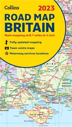
Full color double-sided map of Great Britain at 8.7 miles to 1 inch (1:550,000), with clear, detailed road network and administrative areas shown in color. With its political coloring of counties and unitary authorities it is ideal for business users but it is also perfect for tourists as a route planning map. Main features:
- Fully updated- Counties and local council areas shown in color- Clear, detailed road network- Town and city names, rivers, railway lines and canals are clearly shown- 16 city/town center street plans- Index to place names- Mileage chart- Car ferry routes- Key in English, French, and German Area of coverage. Double-sided road map covering the whole of Britain. Northern England, Scotland and the Isle of Man are on one side with Southern England and Wales on the other.
- Fully updated- Counties and local council areas shown in color- Clear, detailed road network- Town and city names, rivers, railway lines and canals are clearly shown- 16 city/town center street plans- Index to place names- Mileage chart- Car ferry routes- Key in English, French, and German Area of coverage. Double-sided road map covering the whole of Britain. Northern England, Scotland and the Isle of Man are on one side with Southern England and Wales on the other.


今日66折


您曾經瀏覽過的商品

購物須知
外文書商品之書封,為出版社提供之樣本。實際出貨商品,以出版社所提供之現有版本為主。部份書籍,因出版社供應狀況特殊,匯率將依實際狀況做調整。
無庫存之商品,在您完成訂單程序之後,將以空運的方式為你下單調貨。為了縮短等待的時間,建議您將外文書與其他商品分開下單,以獲得最快的取貨速度,平均調貨時間為1~2個月。
為了保護您的權益,「三民網路書店」提供會員七日商品鑑賞期(收到商品為起始日)。
若要辦理退貨,請在商品鑑賞期內寄回,且商品必須是全新狀態與完整包裝(商品、附件、發票、隨貨贈品等)否則恕不接受退貨。